Written by Neon
Chile Chico was a small town, though we could tell tourism was a large part of the town with many people making the short side trip from the Carretera Austral to visit this port-and-border town. It was Fidgit’s birthday as we came into town, and we were able to get a giant and delicious lunch, so we weren’t walking around hungry for too long. We spent the night in a campground right outside of town, resupplied the next day AND were able to find some decent maps of our next stretch of walking going into Coyhaique. Unfortunately, we were not able to get across Lago General Carrera, so had to spend another night in town. Thank goodness for wine and good conversation!
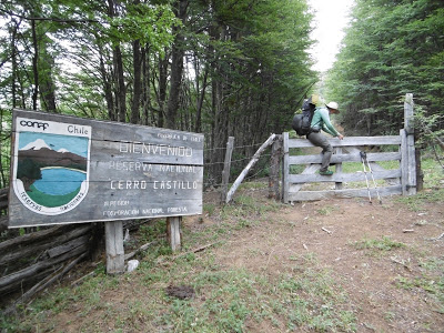
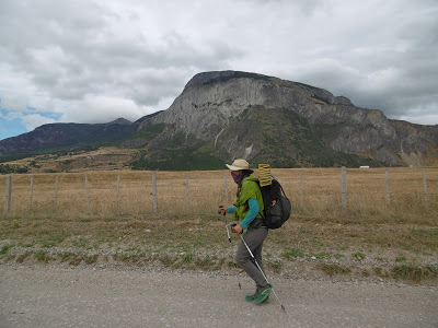
Leaving early in the morning, there was a faint chill in the air. The dock was the only place in town abuzz with activity, as we’ve learned mornings are not something most Chileans do. Having been up late, I fell asleep for most of the multi-hour boat trip. I woke up, and we docked and disembarked. The walk out of town seemed all uphill, and we zig-zagged up a steep dirt road towards Cerro Castillo and its tantalizing mountain views. After multiple days of road-walking, we were ready to be on-trail again. But first, the road walk.
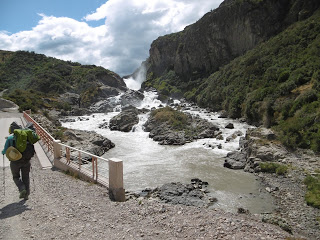
We followed Chile’s attempt at a trail- the Sendero de Chile (remember that from an earlier post??) for about a day along the road, and then it went off the road!! We were aghast, and followed the Sendero markings down a smaller dirt road, past a fishing resort situated between two lakes. We stopped at the resort and talked with the chef. He said we could hang out on their deck for our morning break and was able to give us information on where the Sendero went- turns out it went right into Villa Cerro Castillo! He also brought out some leftover desserts and yogurts, such a hospitable guy.
We moved onward to the small town nestled at one of the entrances to Reserva Nacional Cerro Castillo. Walking into town, we saw many people trying to hitch-hike out of town. I was glad to not be among the droves trying to get a ride, instead able to rely on myself to get to Coyhaique. We ate a late lunch in the town square and walked into the Reserva. As we were about to head up to the first camp, a horse caravan came down and their guide warned us it was going to be cold and windy at the camp we were planning on going to. After consulting with a few others who had come down the path after the horseman, we heeded his advice and called our day a bit early.
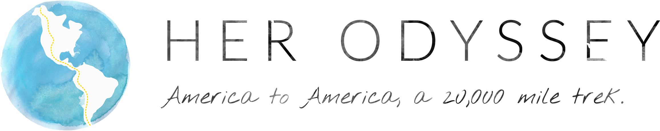
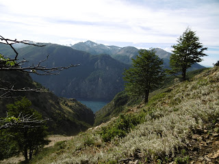
Good thing we stayed low, because we had a giant windy climb the next morning up over a pass to a glacial lake where it began raining and stayed windy for our excursion down and up another valley, over a windy exposed pass, then down ANOTHER valley to camp. Thankfully this was on-trail hiking, as Cerro Castillo is a popular trekking loop not far from the Regional Capital of Coyhaique. The weather may have been cold and windy, but my spirits were high, we were on trail in the mountains again! Having some peanut M&Ms also helped the situation, but the mountains! Muy Hermoso.
It was decision time again. We had heard about a route that went more northerly up a valley. The traditional way is to continue following the valley we were already in down to a road and hitch from there. We are obviously not proponents of taking a ride, so we tried to get some information from the park ranger who was conveniently at our camp that night. After an hour and multiple stories, he acquiesced and showed us a Lonely Planet book (in English!) that had a route description. He also warned us that so few people go that way he wasn’t sure how the trail would be, as it’s no longer kept up by the park service.
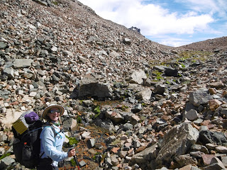
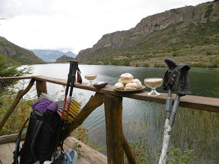
We left the ‘back country’ ranger station the next morning, made sure to make the required left across an unkempt bridge, and followed an old dirt road nearly up to the pass. The road petered out and a trail continued up through the forest then across a rocky face to the pass, cairns marking the way. The ‘trail’ on the other side of the pass was a different story. The cairns ran out just as the alpine meadow did, as we came upon at a thickly forested steep valley leading down to Lago Paloma. Because of the trees, we could only see the lake on our GPS, so we had to bushwhack down the valley until we got to an area too steep to walk down and went up the valley side. We repeated that a few times, and we popped out on an area that was obviously a giant rock slide. And by giant, I mean the entire right side of the already steep valley was loose dirt and rock.
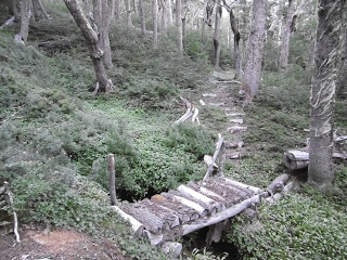
We carefully picked our way up and across the rock slide area for 3 hours, and came face to face with a steep gully. We butt-slid and dropped from tree-to-tree down the gully and headed back up to finally find a lovely campsite along a small stream near where we thought the trail should be. We both fell into an exhausted sleep after setting up camp, eating dinner, looking at our GPS maps, and getting water. The next morning, we decided to head uphill from where we camped in search of the trail. Lo and behold, up a drainage about half a mile, a human-built bridge! We were back on the trail and able to follow it down along a few meadows the rest of the morning. We were both so relieved to be on trail that we sang and laughed the rest of the day. At the end of the trail was a road that led to another road that led to another toad that led down towards Lago Paloma and also into Coyhaique. We were nearly to our next town stop!
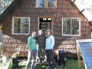
Road walking is a struggle in itself, but I didn’t mind as much as the concern for being lost and on a steep valley side melted away while meandering along the dirt road and was replaced by concern for where we would sleep and get water that night. We walked into Coyhaique in a day and a half, and were overwhelmed- the Capital of the Aysen region was the largest town so far. There were people everywhere, and some of them were quite talkative. Thankfully we were welcomed with open arms into the home of Sandra and her family and had a wonderful multi-day respite.

Comments (1)
Thanks for sharing your descriptive adventure.