Written by Fidgit
A Summary
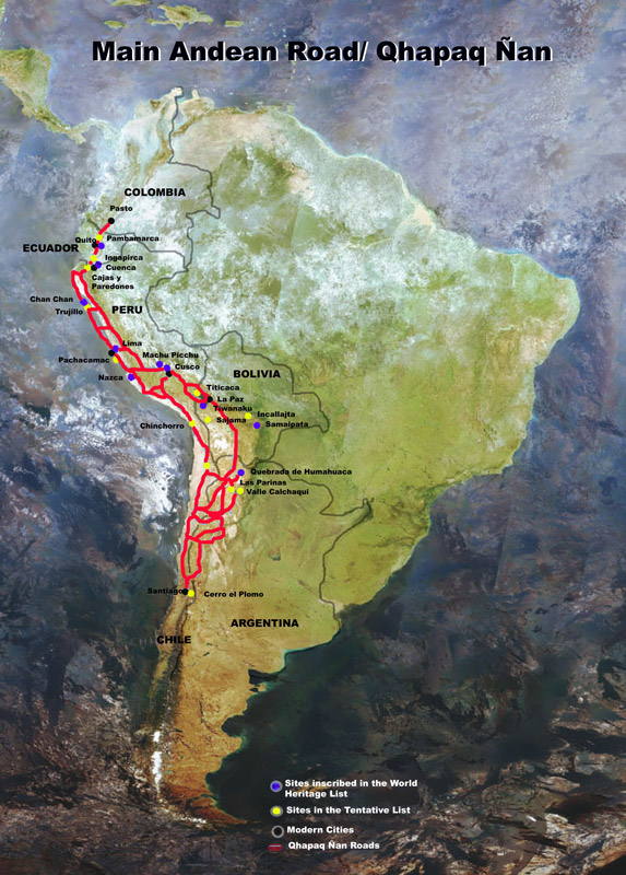
The Qhapaq Ñan or the GRI (Gran Ruta Inca) is the Inca road system which, at its height, was almost 40,000 km long. It connected the Andes from central Argentina and Chile to southern Colombia. Two primary arteries ran latitudinaly, one along the coast and the other along the puna or high planes. Many connecting roads allowed for movement of goods between the jungles of the eastern slope of the Andes and the Pacific Coast to the west.
The road system was used to maintain Incan dominance over the many tribes which had been, shall we say, absorbed by the Empire. Goods and messages were transported to and from the central focal point of the roads, the proudly titled, Navel of the World, Cusco. Messages were carried by Chaskis (a name guides still draw pride in being called) who traveled quickly between tambos, which were resting stations maintained roughly every 27 km along the roads.
Today the ancient road system is segmented.
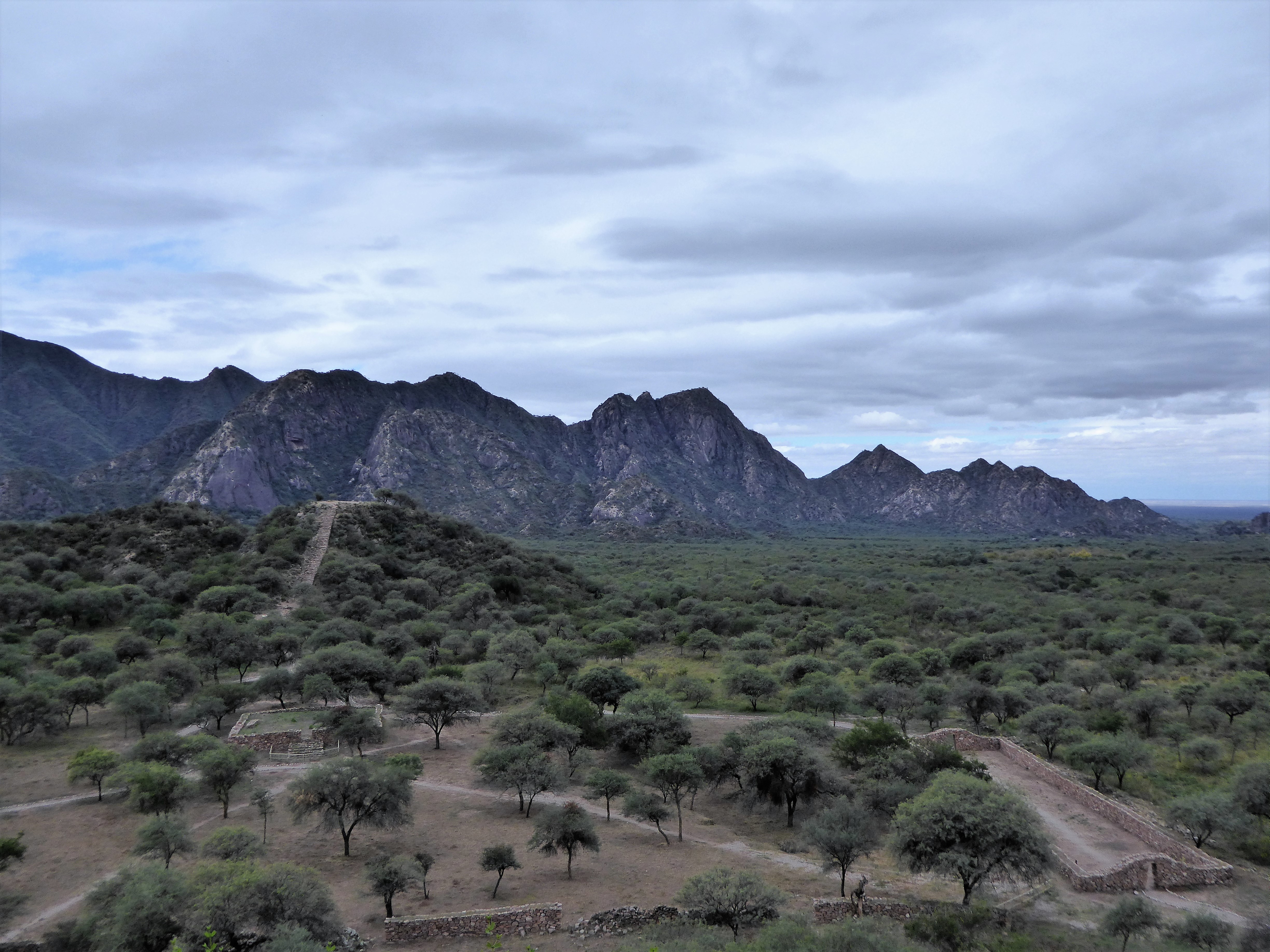
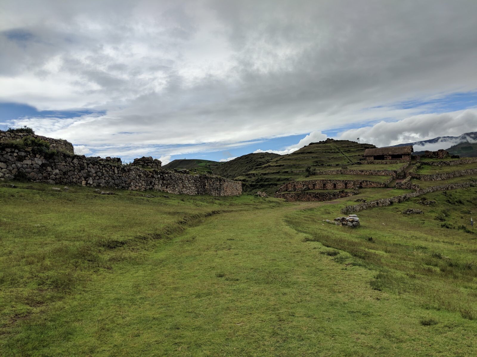
In some areas it has been layered over by modern transport such as roads and rail lines. Machu Picchu is a world renowned and inundated tourist attraction. There are hundreds of other sites maintained and just as interesting to visit, and thousands more still buried.
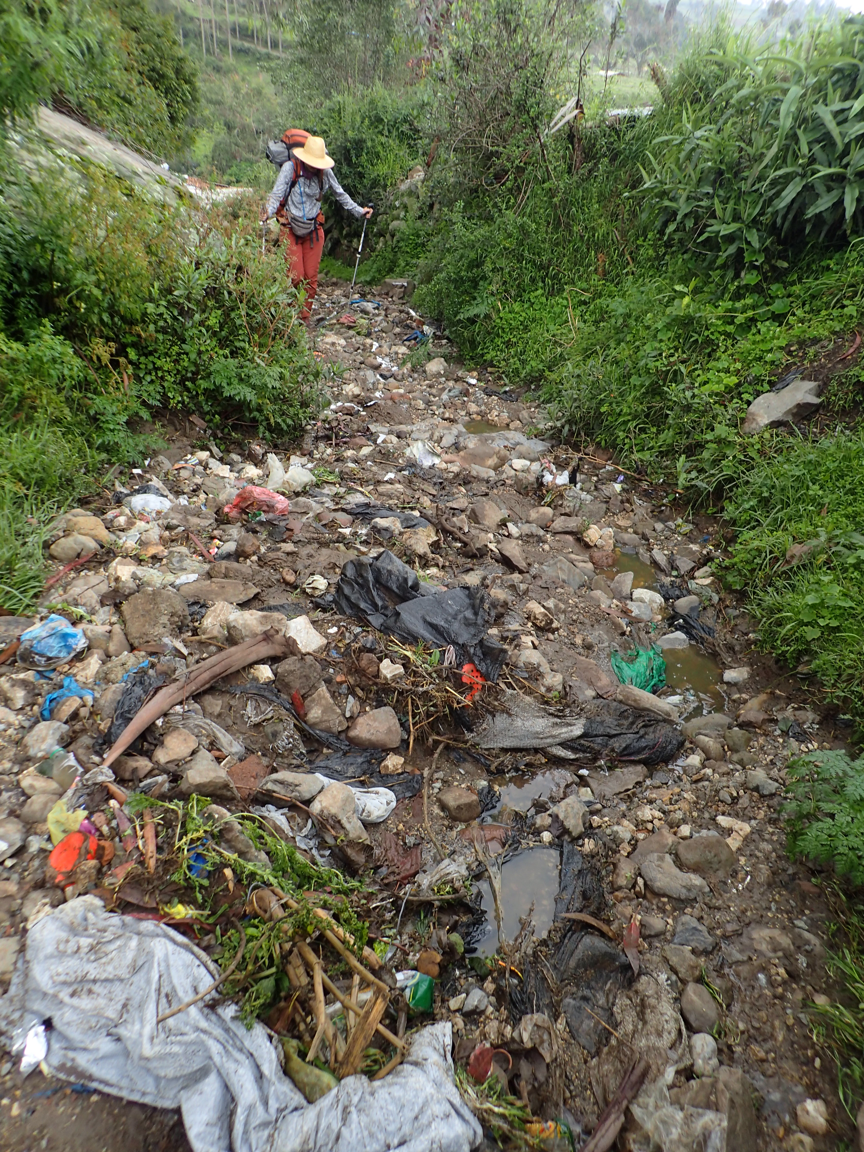
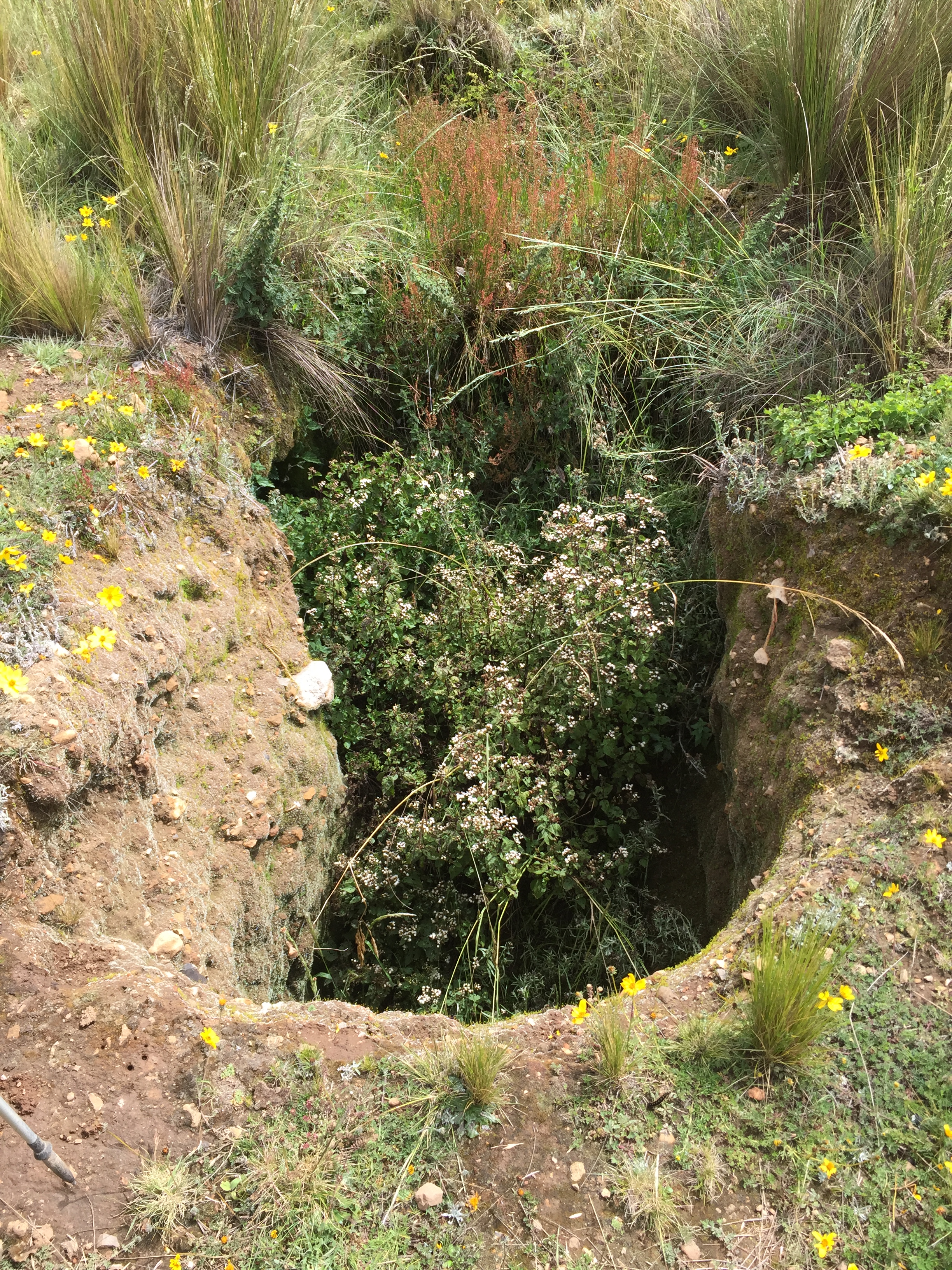
Other segments have been plowed up by local farmers to make their chakras, stepped planting fields, or the stones once used to pave the road have been re-purposed to build houses and fences. The areas of the road system outside of towns are deeply worn into the earth and are now used as dumping pits for trash.
 A precious few lengths are forgotten by all but the locals, remain largely undisturbed, and are wonderfully walk-able.
A day on the Qhapaq Ñan
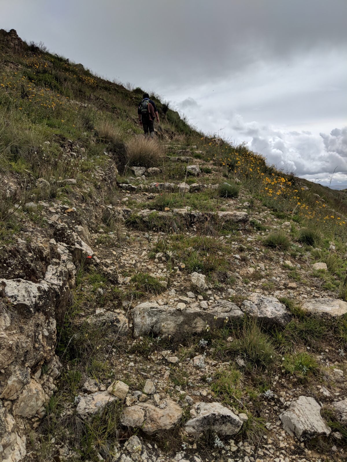
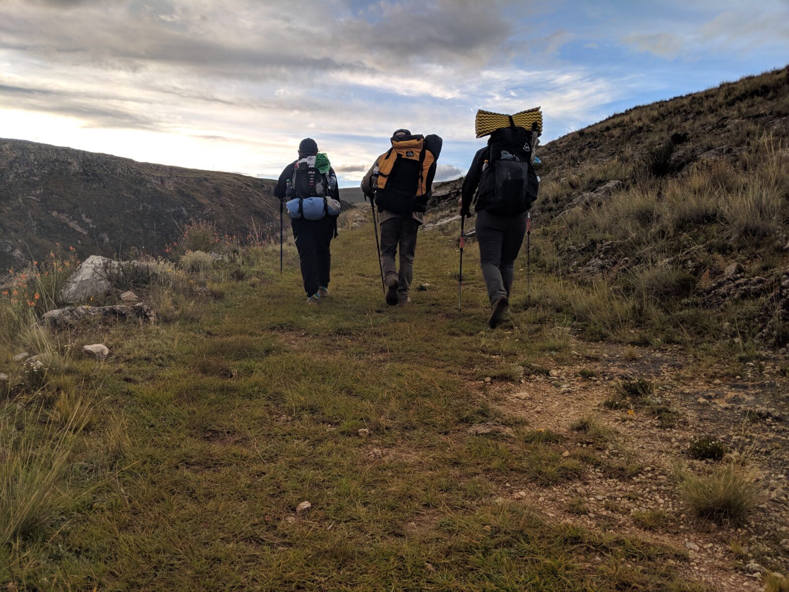
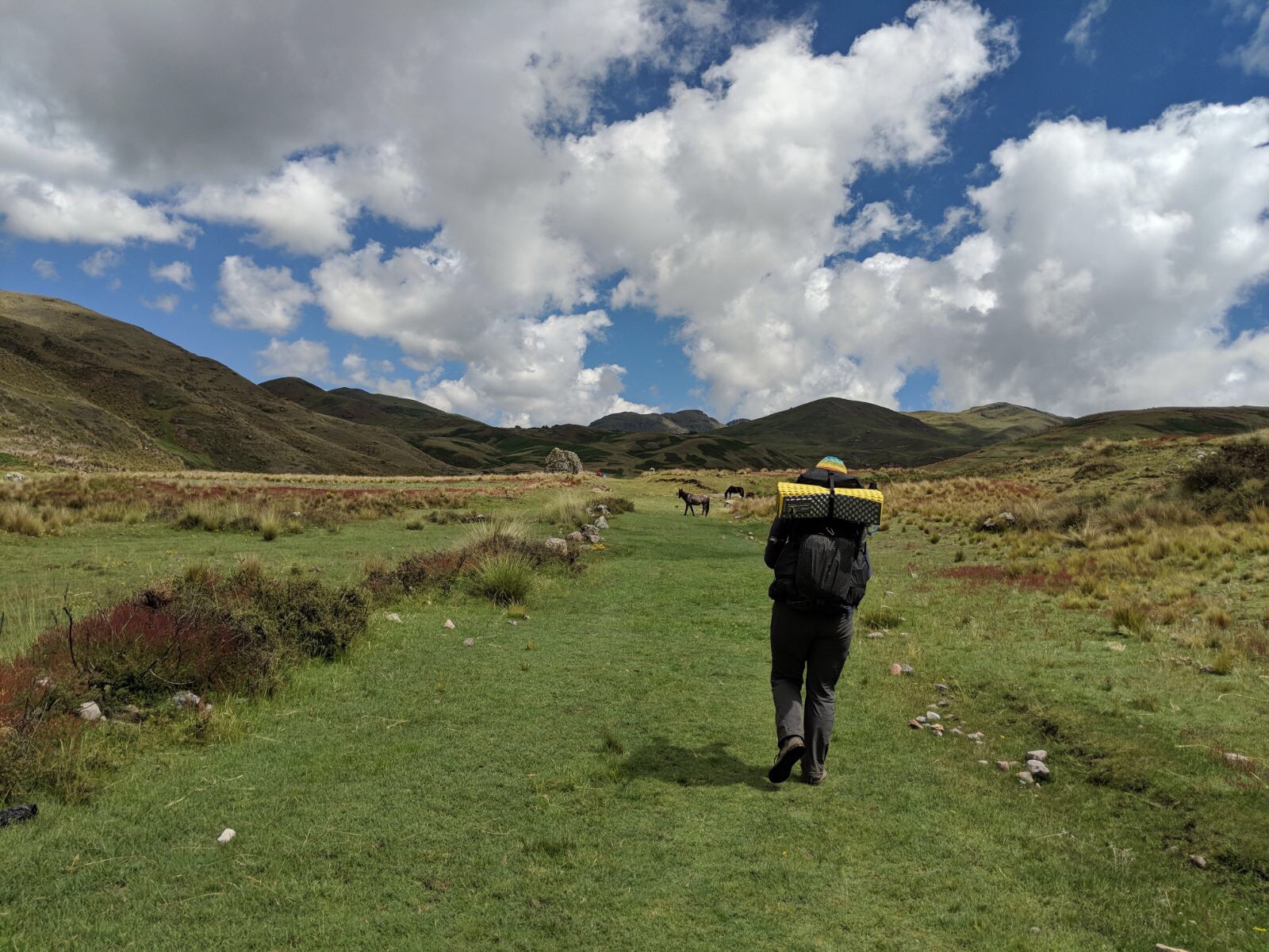
We have followed the puna (high planes and mountain) route of the road for some 4,000 kilometers now, and despite the toll time and development have taken, this road has a recognizable feel. It tends to stay high, not shying from climbs. We can look at a mountainside and reasonably guess where the road went. We can recognize the arrangement and lay of stones set by the Incas. After a few days walking with Pedrito, a Chaski in Jauja, Peru, we feel confident that the way we have approached navigating the road system is about as on par as one can be when following a road built six centuries ago.
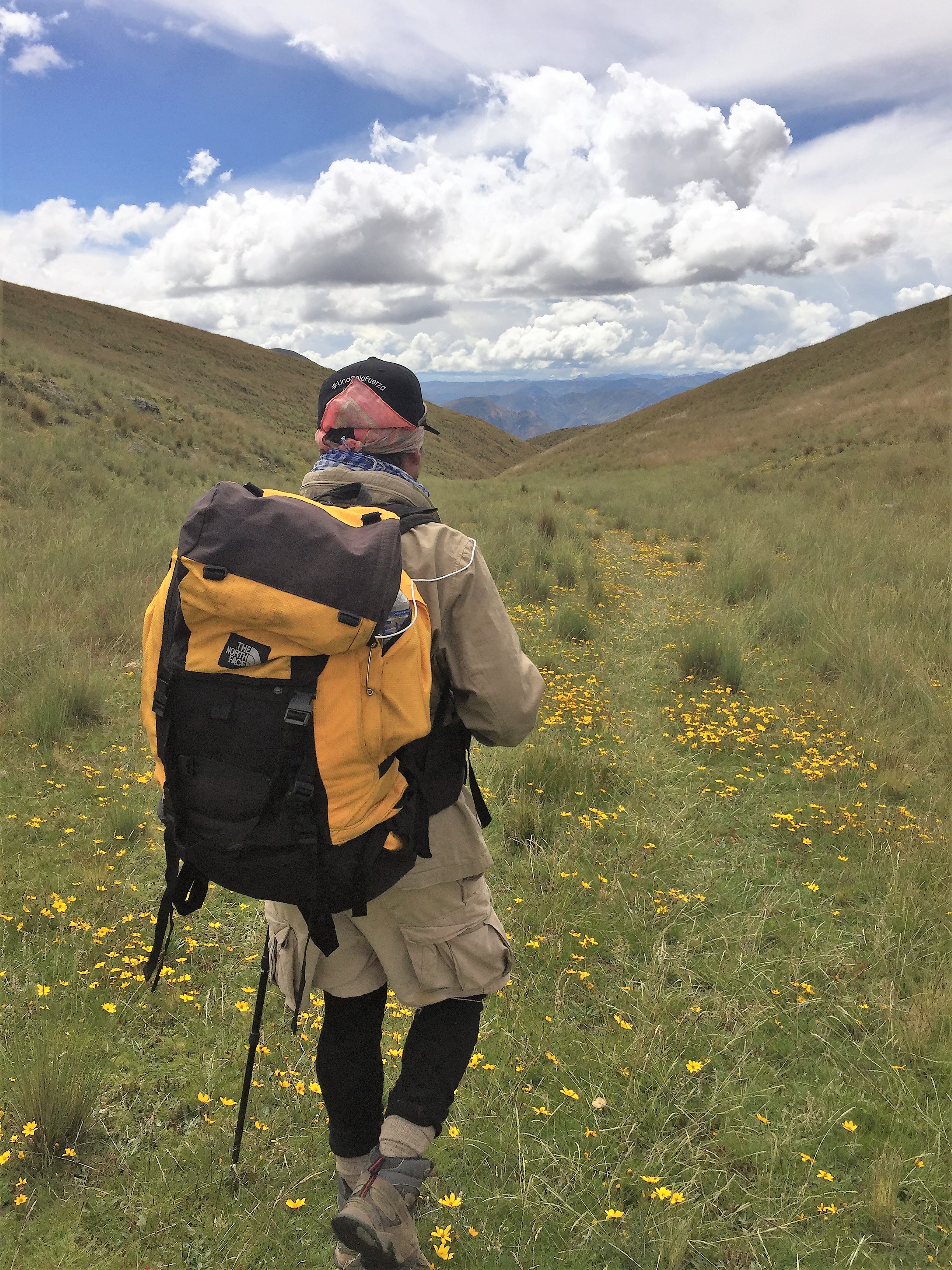
Talking with locals is central to navigating the Qhapaq Ñan. Many of them still walk it with their animals or to their chakras and back each day. We have taken directions from everyone from a 12 year old girl to an ageless grandmother sitting on her stoop directly along the route. These are the guardians, and it is a bare minimum of courtesy to say hello and goodbye, even if you are just trotting past. Better yet, learn a few words and greet the elders in Quechua.
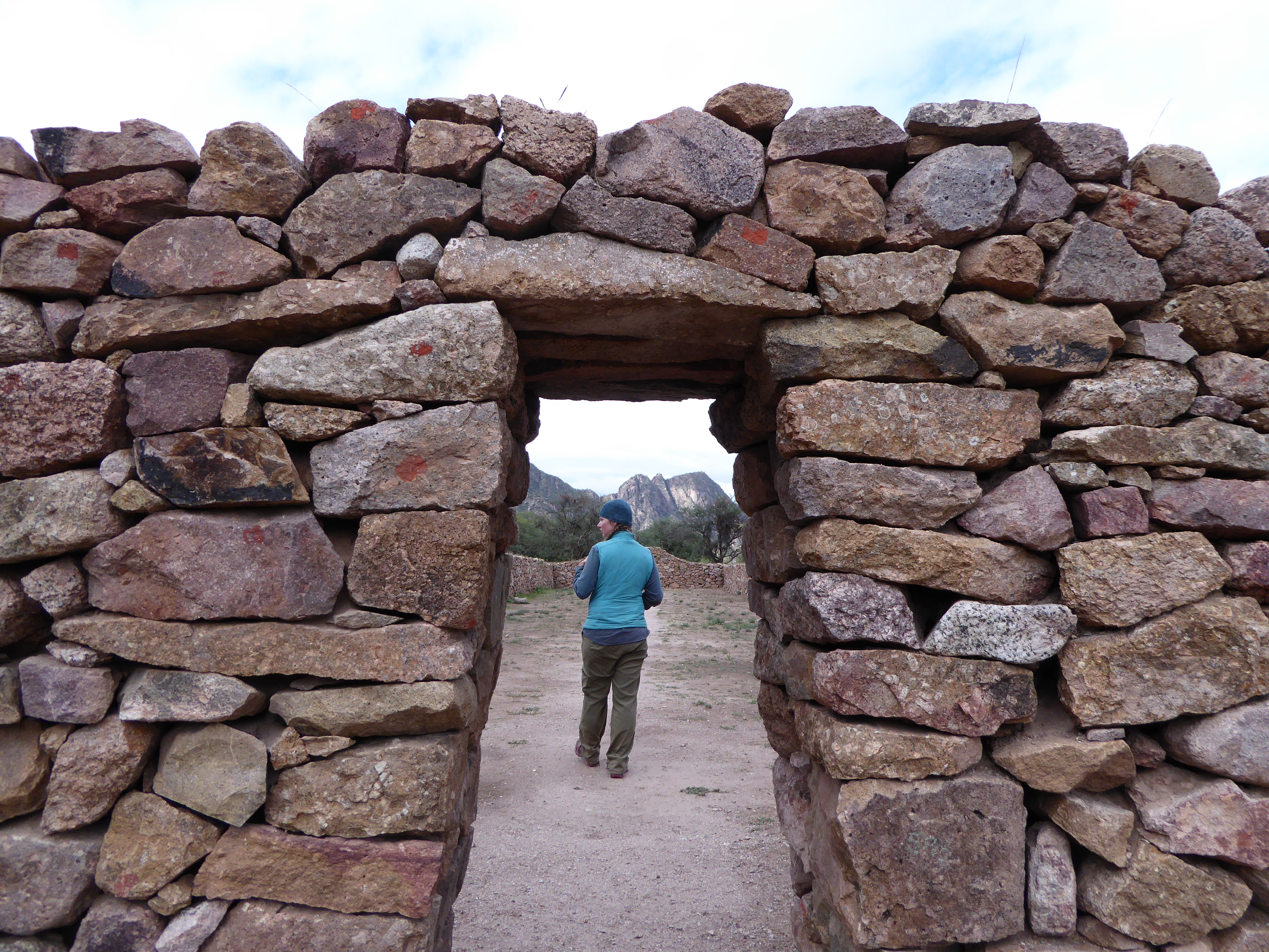
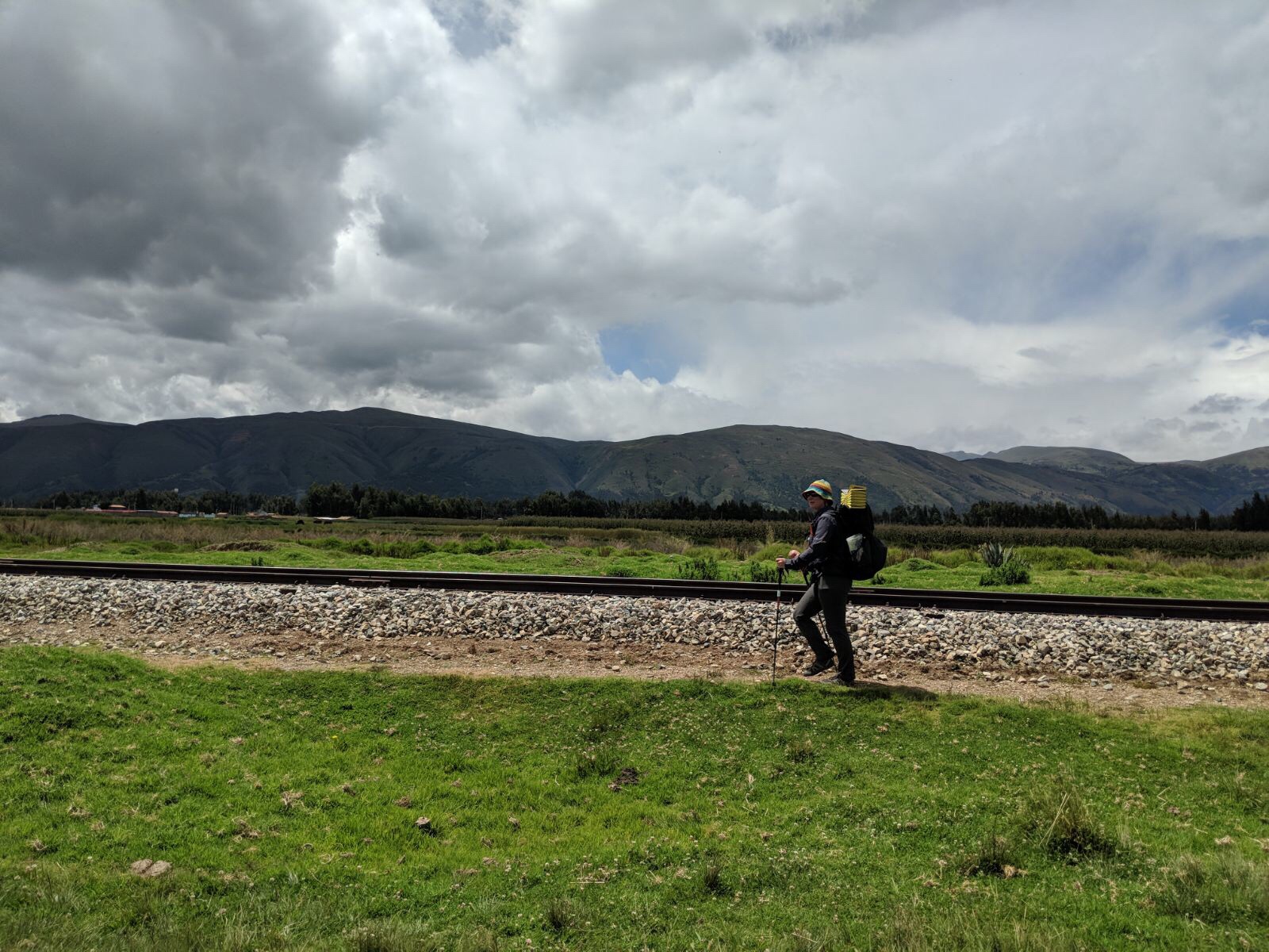
The route itself will be a combination of the surfaces described above. A significant portion involves roads. Northern Argentina is a prime example of this, as Ruta 40 essentially went over the top of the ancient roads. Almost all of that area is highways and dirt roads. Original tambillos, ruins, and even some pre-Inca pictographs remain, though these are largely tucked back into the mountains and the locals tend to keep them relatively secret, sometimes sharing their locations, but only on the promise that we not proliferate the information. A site very much worth your visit is El Shincal just outside of Belen, Argentina. Rosa Ramos is one of the guardians there and a delightful woman.
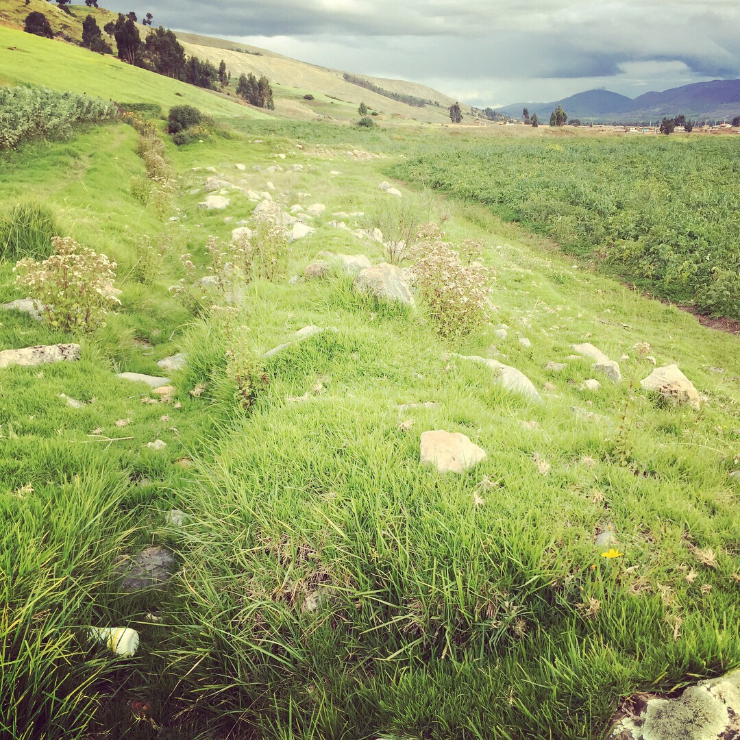
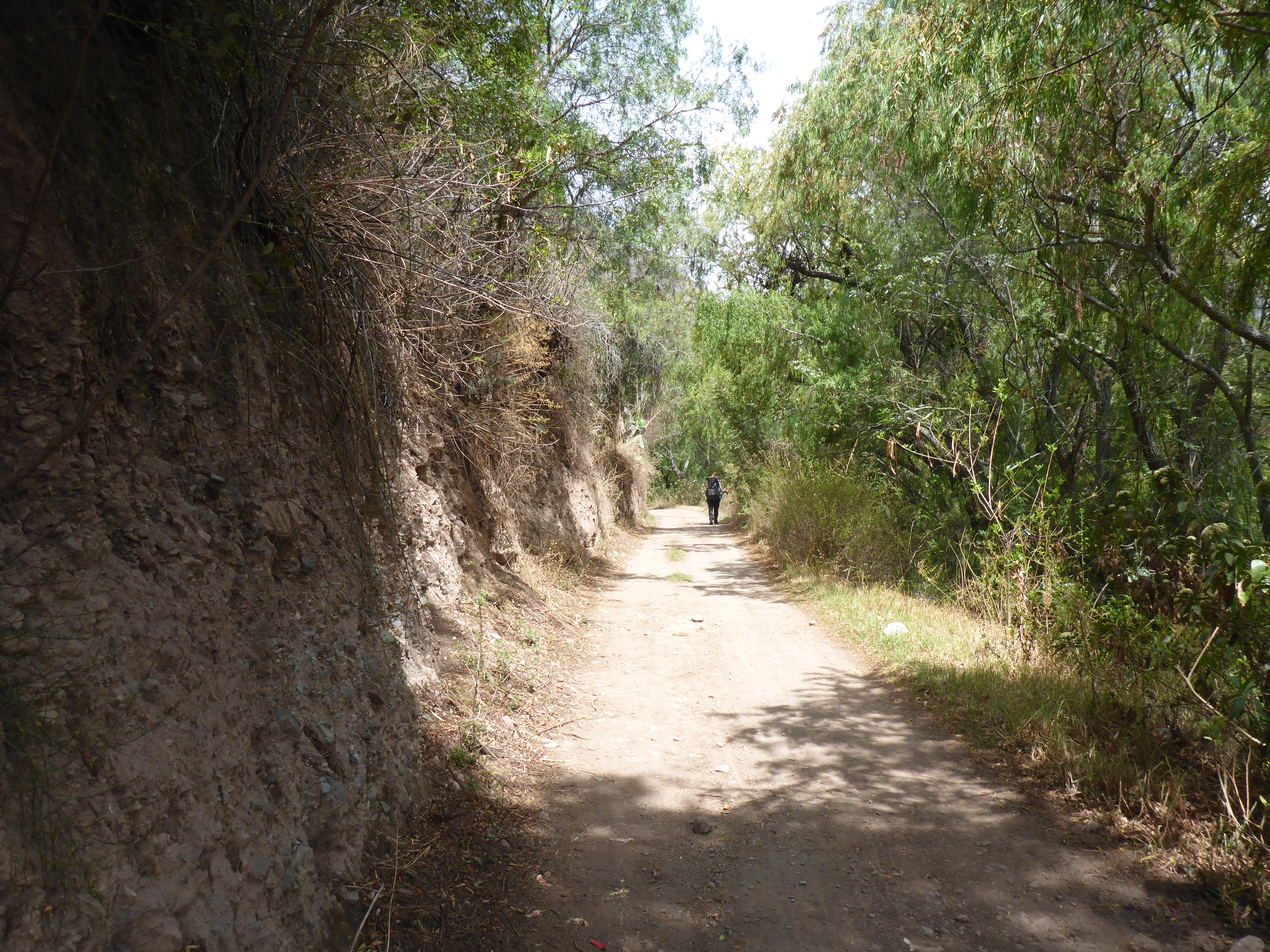
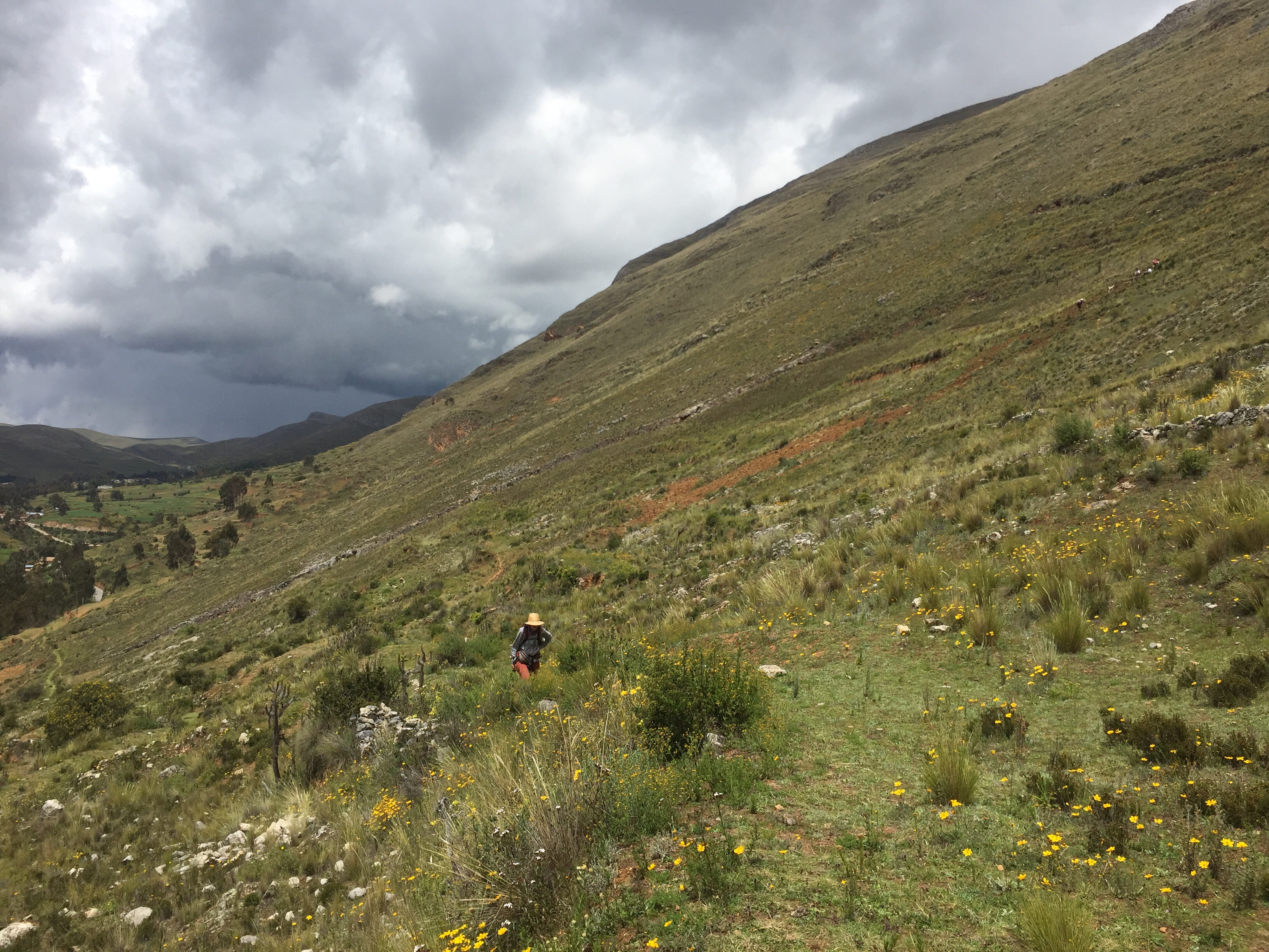
Through Bolivia and Peru the route is easy to follow, frequently passing through small towns which you will not find on any map, and is still in use today as people move their animals and work their crops. I very much enjoy these stretches and we have learned it is wisest to follow the most worn footpaths rather than the line on the GPS as the walk-able routes change with the season and year.
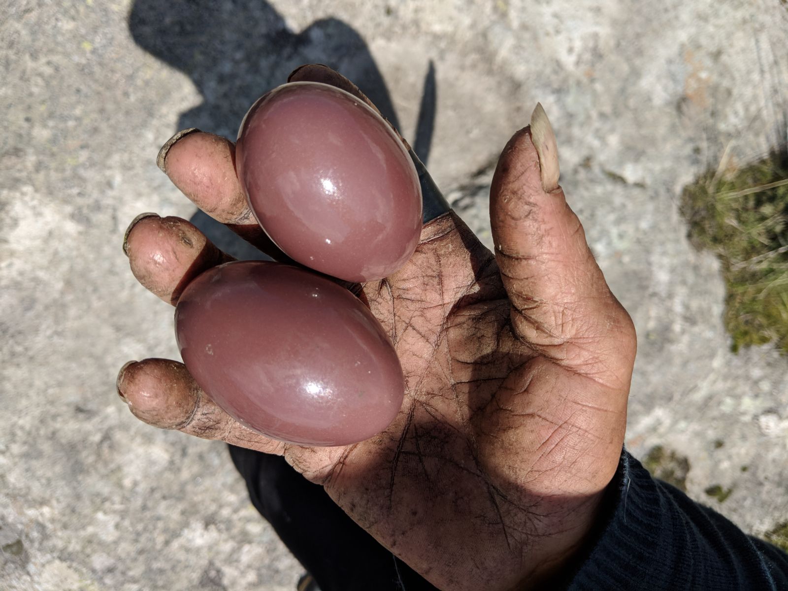
Much historical and financial value has been stolen from the Peruvian people. Mummies exhumed, precious family heirlooms “borrowed” by visiting documenters and then never returned. Particularly in Peru, people are convinced Inca gold troves remain buried and have a distrust of outsiders. The impression I get from conversations is that they do not oppose these treasures being uncovered and taken, they are just sick of it being taken by foreigners, and they see no improvement in their personal lives for it.
Foreigners wandering along the trail on rarely traveled sections are seen as suspect. DO NOT ask about gold or burial sites, and if information is volunteered or questions asked (“What do YOU think about digging up Inca burial sites?”) I have had success with letting my ignorance and indifference be known and turning it around to ask what they think.
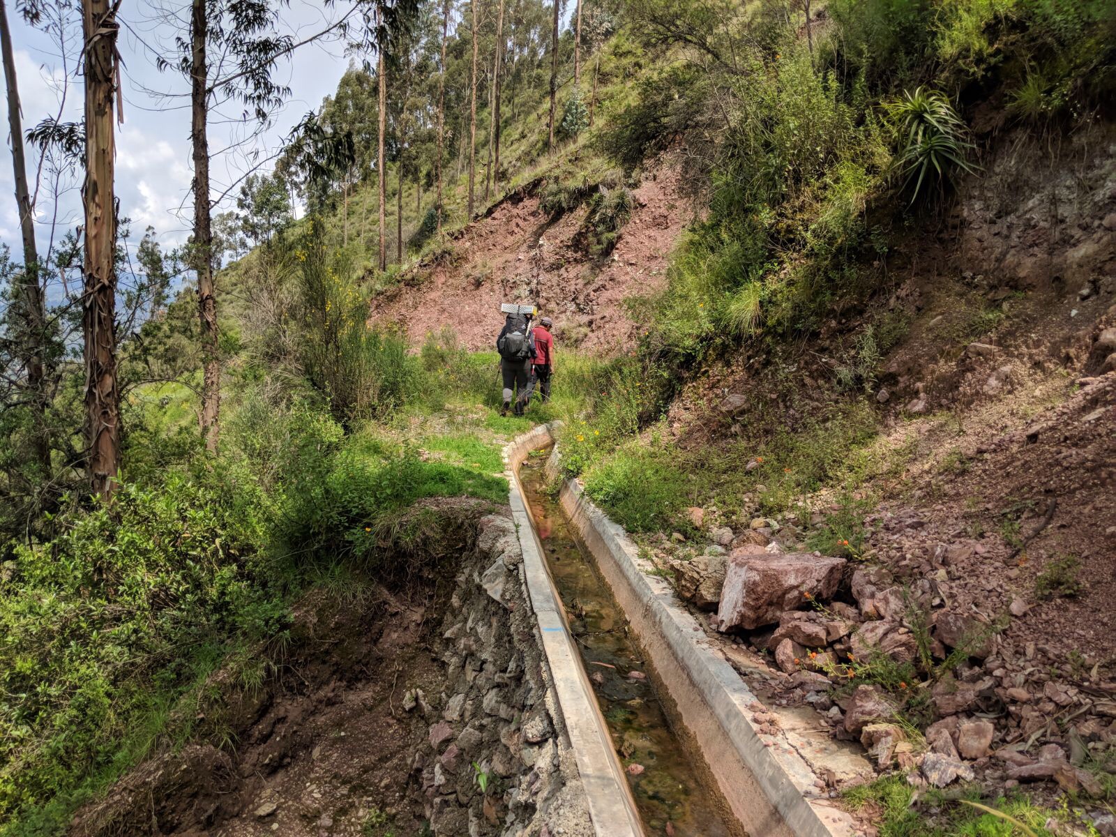
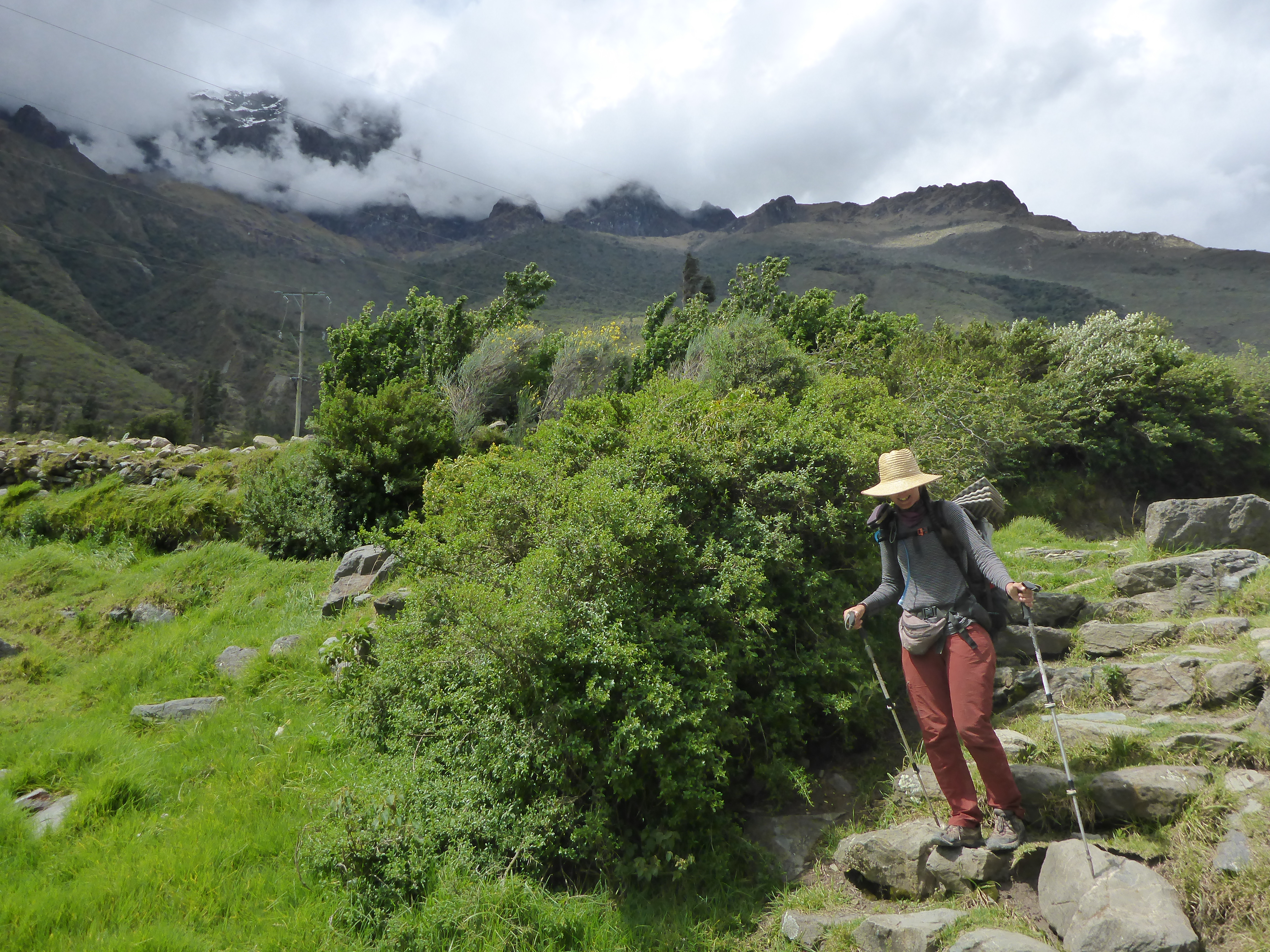
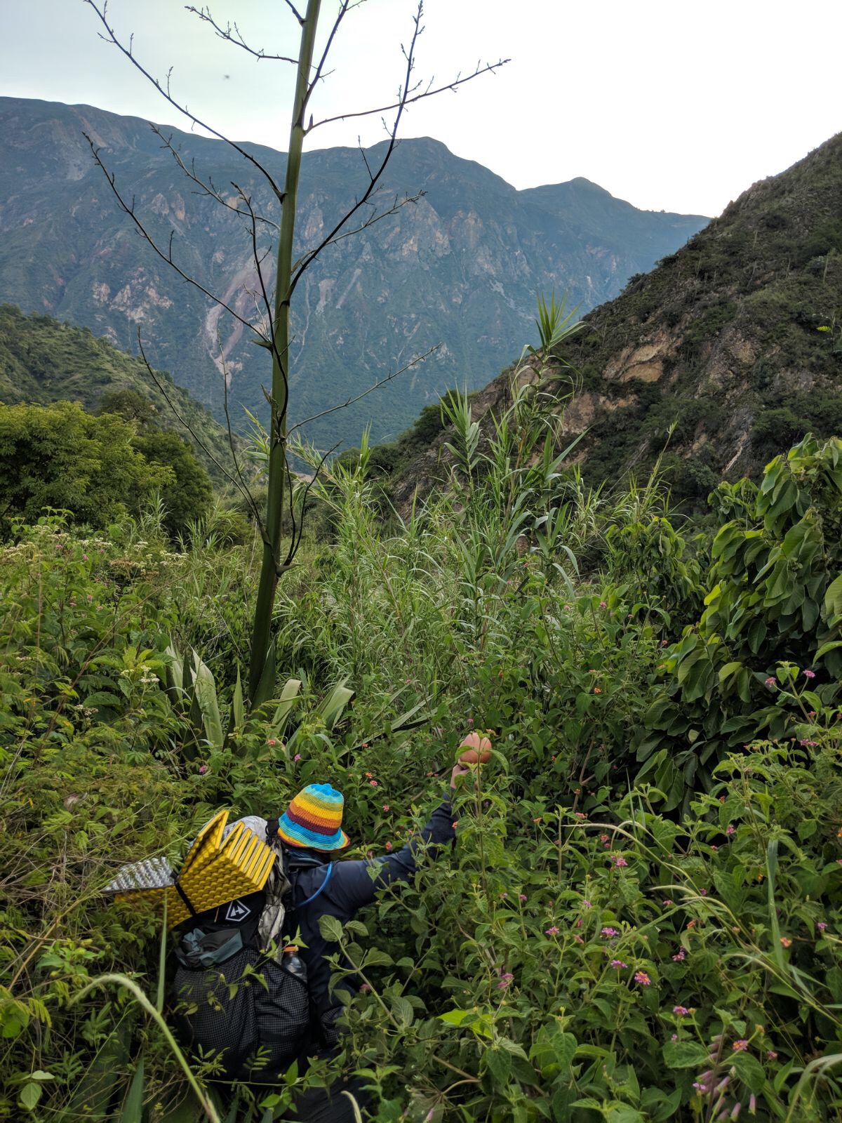
You will walk through a great deal of farming along the Qhapaq Ñan and come to see the prevalent use of pesticides, as well as some of the time proven techniques they still employ. Some stretches follow along an aqueduct between fields, still other sections you skirt the field itself, and in other areas you have to side step the field which has now supplanted the road.
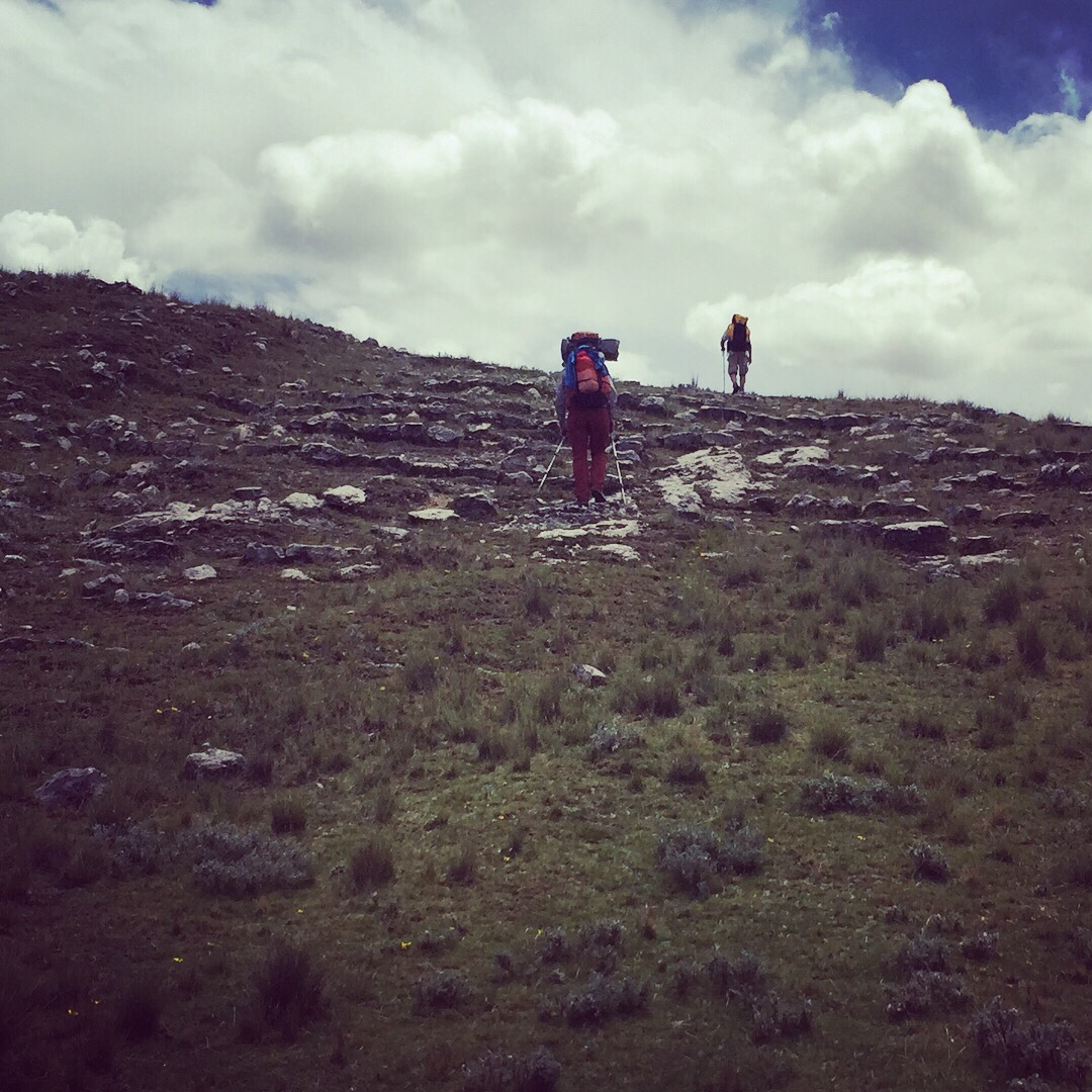
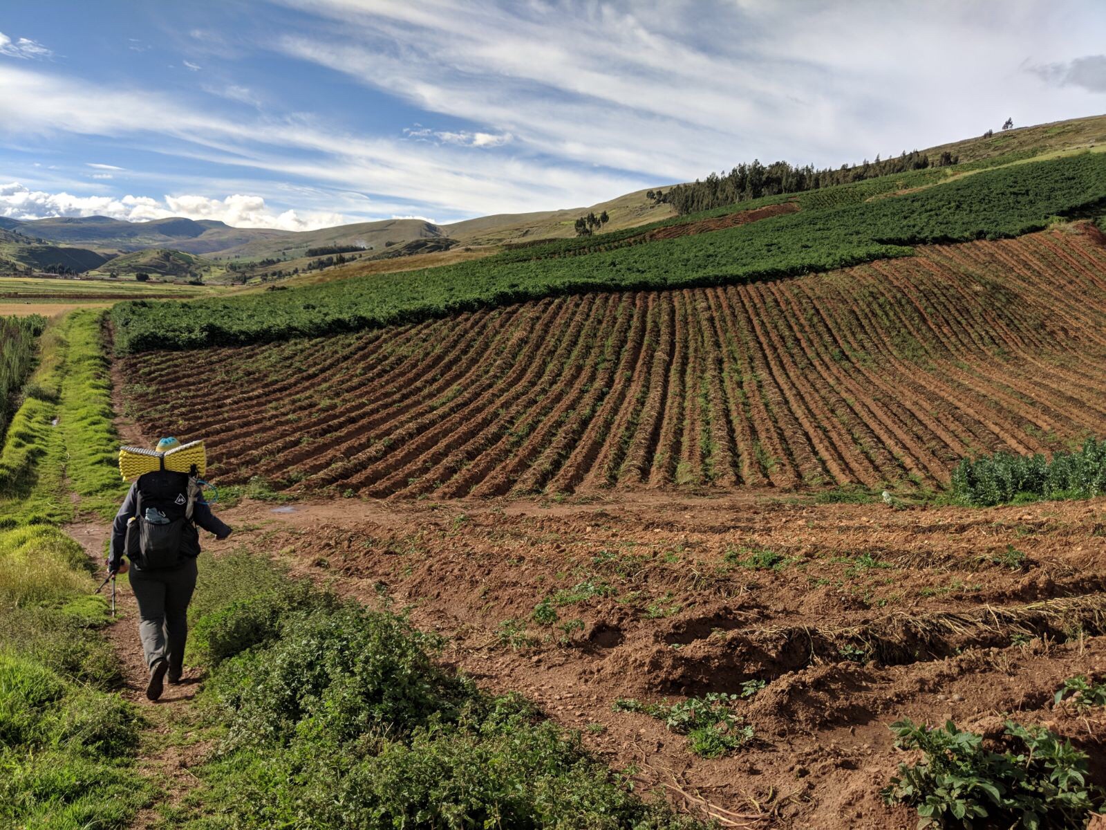
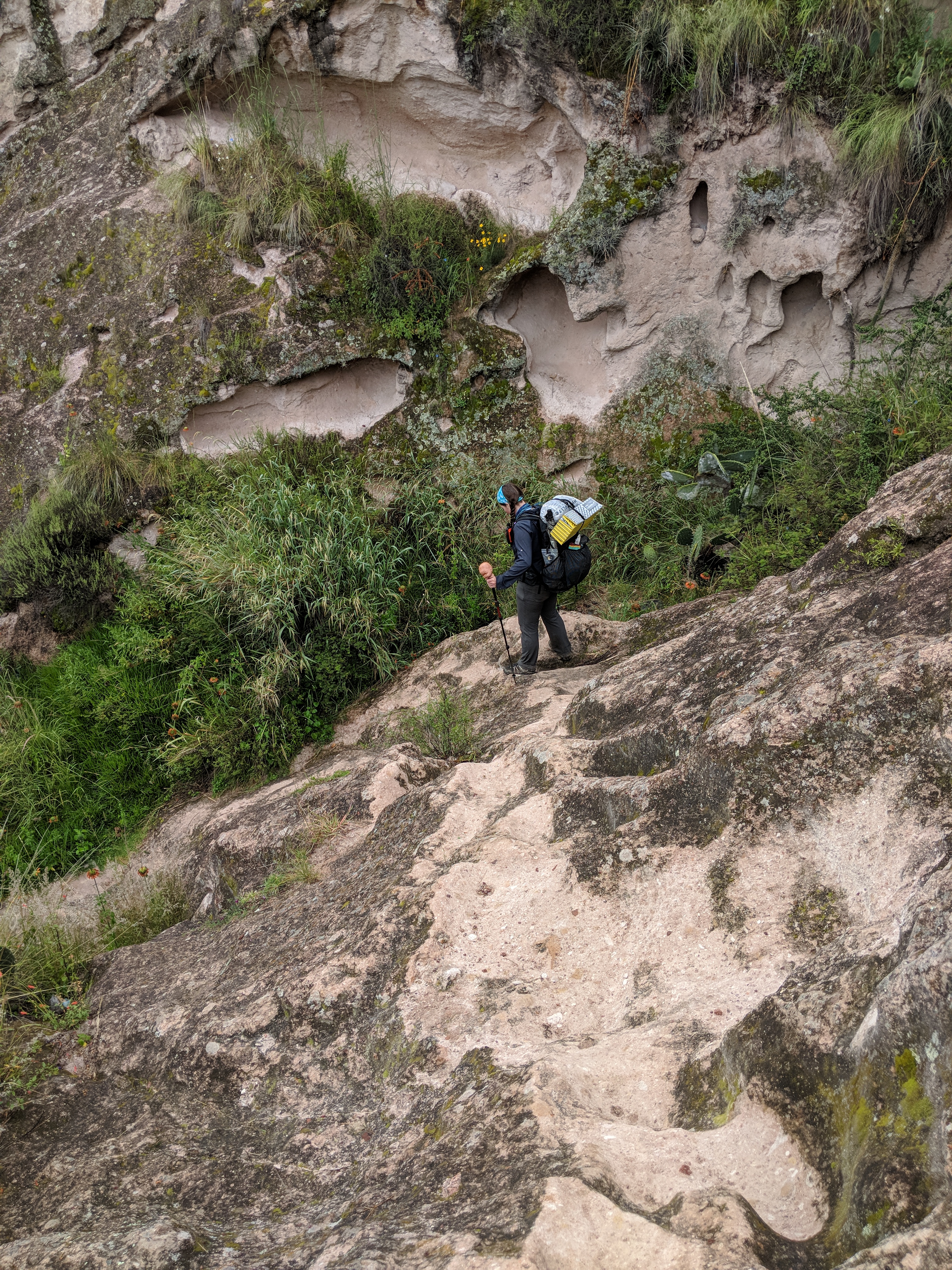
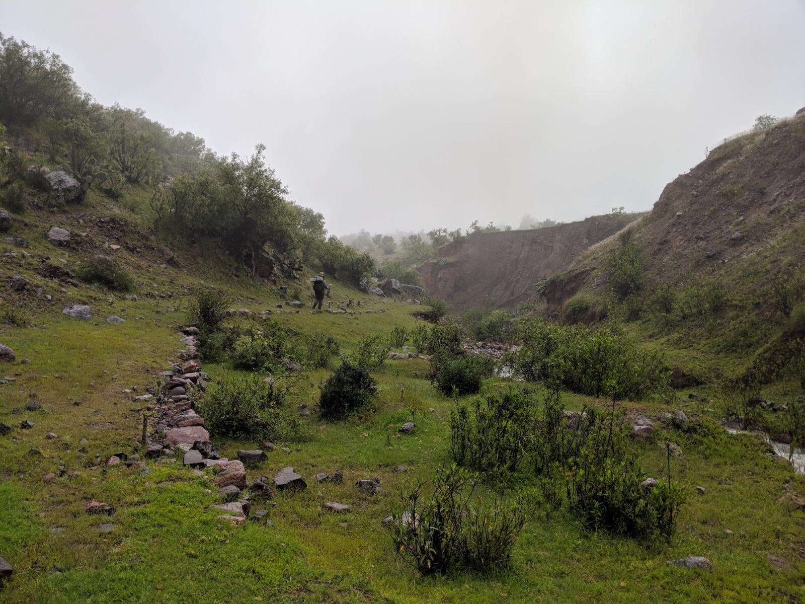
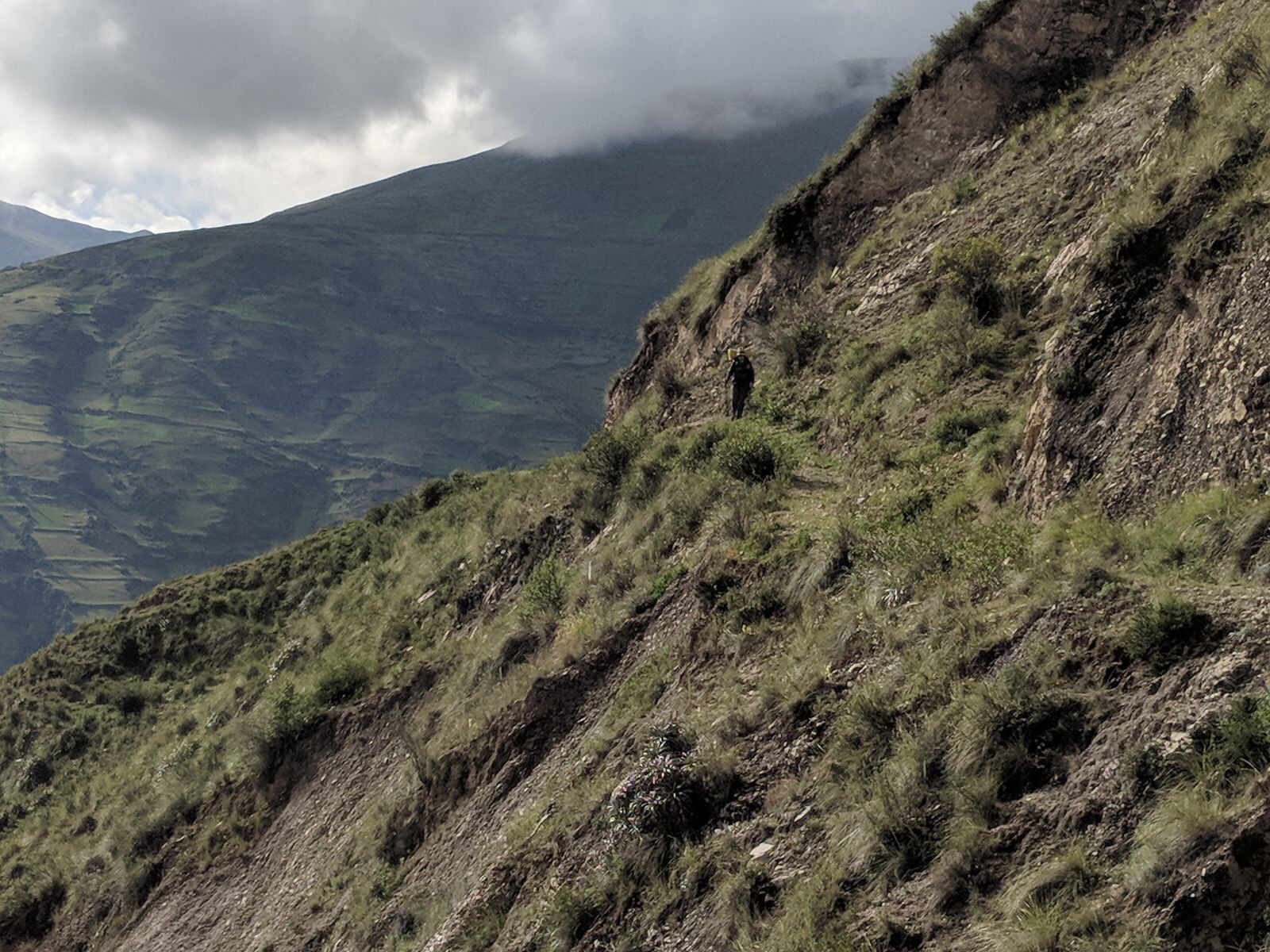
In small sections, the route is completely destroyed by landslides or the wearing of time. At these sections you will find yourself climbing through cactus and rocks, thinking that each next flat chakra above will be it, only to notice the road has reappeared well below you.
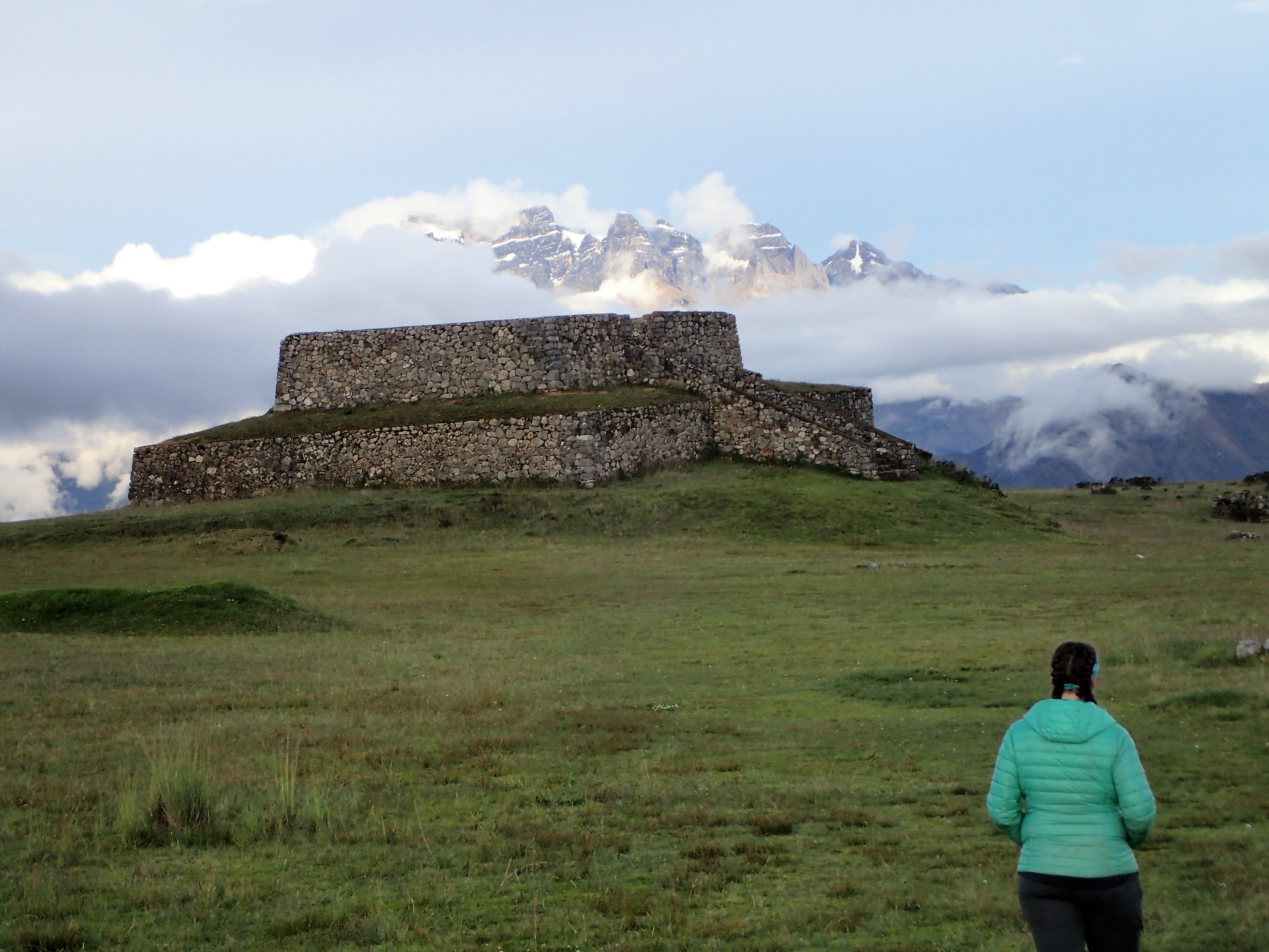
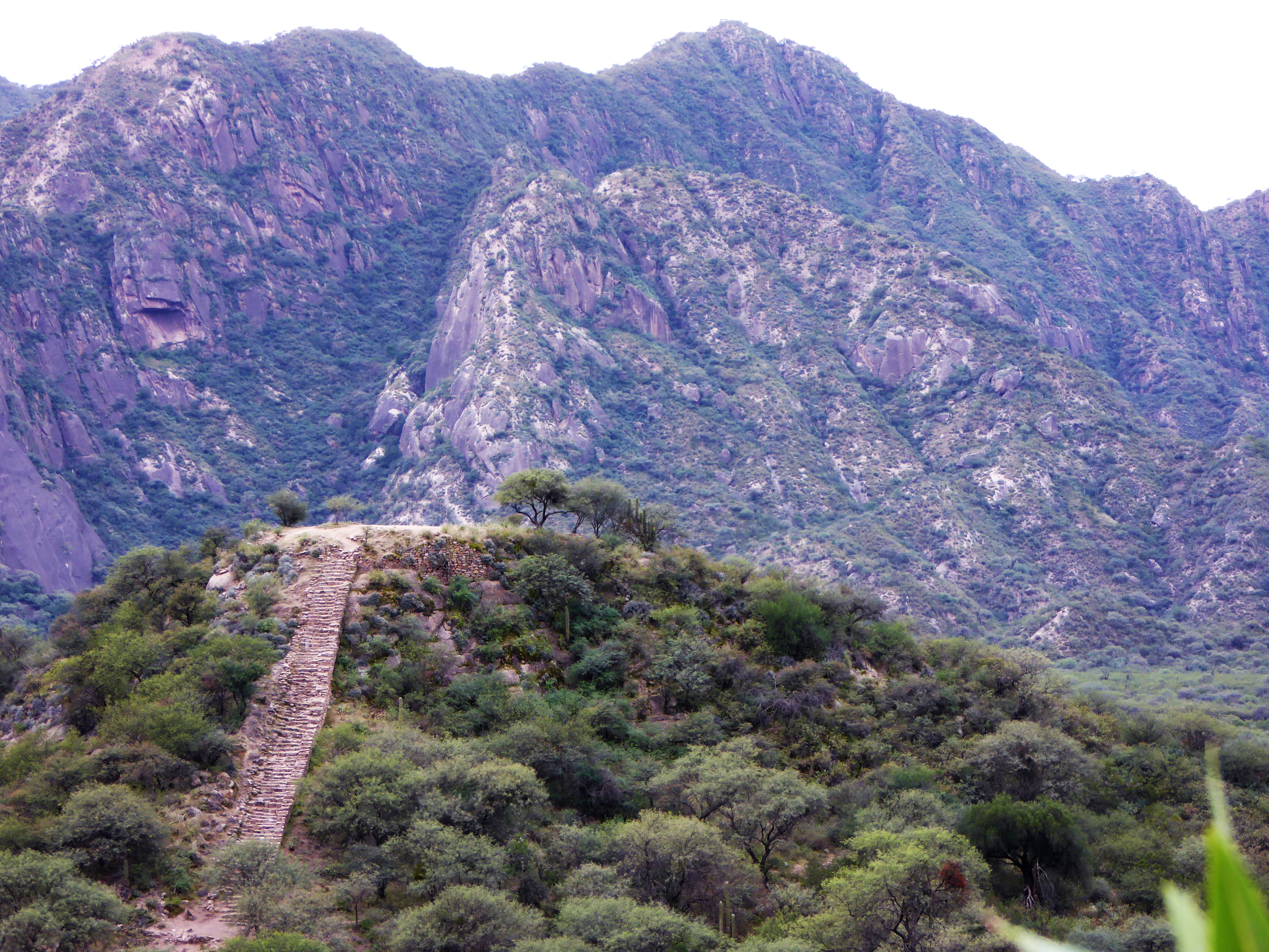
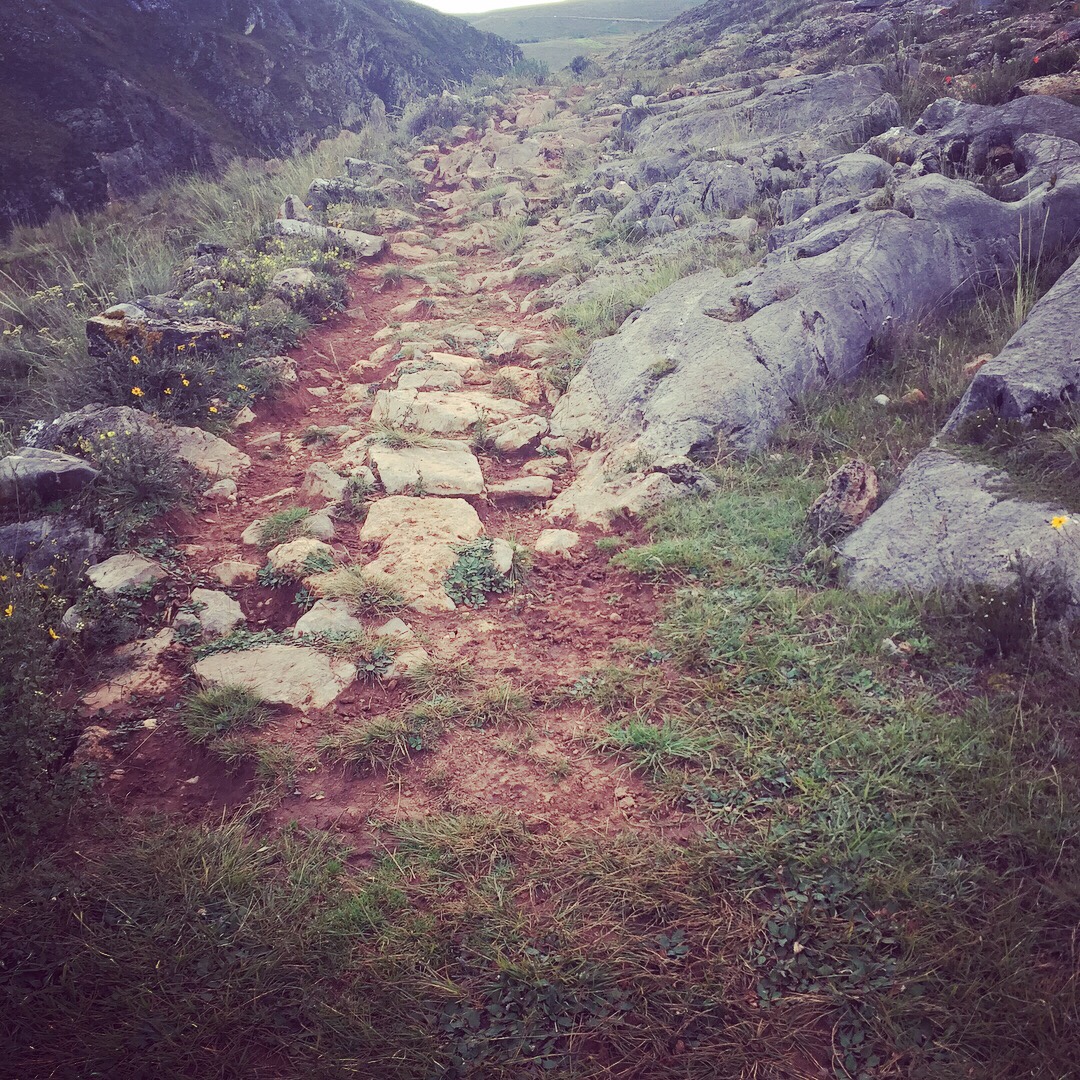
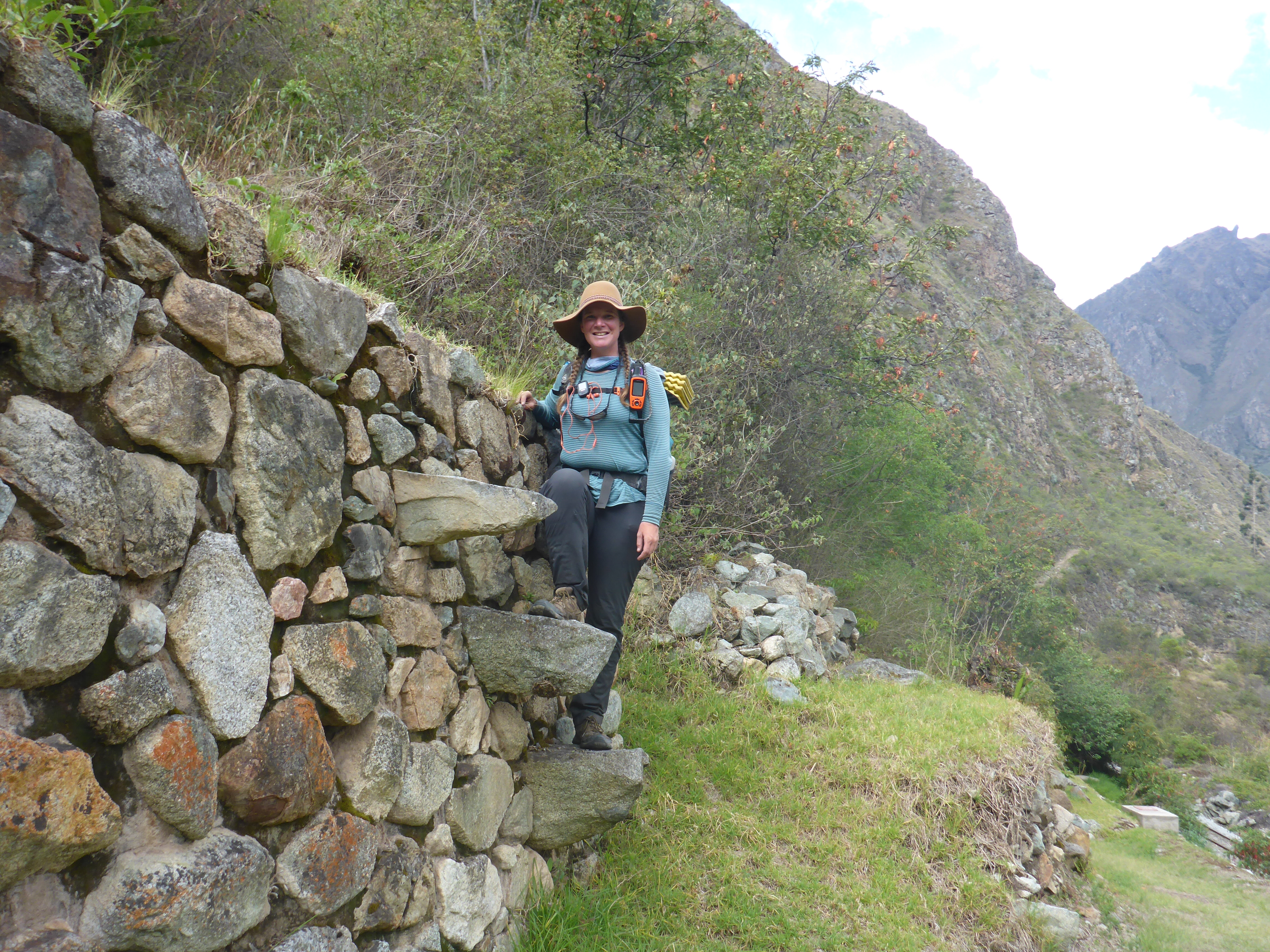
But in other areas, and oh these are the true treasures my friend, the road still stands as it was built. A smooth cobbling of rock or carved smoothly into a rock face, draining water, holding its ground, sometimes as wide as a highway.
Online Route Planning Resources
The UNESCO site offers a KML of official World Heritage Properties along the route.
Simone Dubuis created one of the most detailed KMZ tracks I have found online of almost the entire route in 2012. He details towns, historical sites, passes, and elevations.
The qhapaq-nan.org site, created around 2012, offers a still further detailed rendering of official segments which remain of the road.
While I do not agree with biking directly on the Qhapaq Ñan due to preservation concerns, this Bikepacker route has been a great resource for the length through Ecuador, and it offers an easier dirt road alternative for bikers to follow, which does not tread the original ground as much.
Interesting Reads
Ricardo Espinosa, El Caminante 2002 – La Gran Ruta Inca: El Capaq Ñan– hard to get your hands on, but a primary source for modern travelers of the trail. Its maps make it worth the hunt for those who like to be thorough.
National Library of Peru La Gran Ruta Inca (GRI) y el uso sostenible de la biodiversidad en los países de la región andina: explorando experiencias y potencialidades – a study of the route and biodiversity with some great information and overview maps


Comments (5)
?? Hi 🙂
THANK YOU for all your Trail Taies , wonderful stories 🙂
You’ve helped bring back hidden cultures , lost Trails , forgotten peoples of long ago ,
you’re sharing has lit a lamp of once darkend Paths can now be seen
THANKS ??
Cheers for now
HAPPY TRAILS.
?
Lani
It is my pleasure, Lani. It is a delight beyond words to experience the beam of light and encouragement you shine to this world.
Big hugs from Ecuador!
Thanks for sharing the map of the Inca trail and the significance it still carries for the local peoples. We did enjoy seeing Cusco on our visit to Peru. The visit to Machu Pichu was inspiring. We admire your respectful relationship you cultivate with the guardians of the trail and the local traditions.
It is our pleasure, Cliff. It means so much to have you along for this entire journey!
Pingback: Ingapirca to Achupallas: Emiterio & Tia Ines – Her Odyssey