Summary: A 17 mile loop in South Central Missouri, Big Piney Trail ranges through a variety of habitats. From the vistas along sandstone bluffs to the abundance of plant and animal life in the drainages, this trail traverses it all. A simple loop, or figure 8 allows for practice in basic map reading skills. With three trail head access points, help is never more than a few miles away. Winter and Fall would allow for more expansive views and fewer ticks and poison ivy, oak, and Sumac, but summer makes the natural pool under an 8 ft shelf waterfall a pleasant dip. Easily completed on an overnight hike or ride, this is a great trail for hikers and equestrians alike.

For an easily printed color topo map Visit:
http://www.ouachitamaps.com/Paddy%20Creek.html
Day 1 – Afternoon – Trail-Head
Emily and I had planned to head out Saturday morning by 7. At 8 am we were sitting down to Swedish pancakes. 4 1/2 hours, largely on Highway 7 S, and with the help of several savvy gas station attendants, we found our way to Forest Rd 274. About .75 miles of slippery gravel led down to a parking area at the periphery of an open field. By 1:45 we hit the trail.
The trail took off opposite the road from Roby Lake. Through a wildlife gate and out into open mud. The recent rain, combined with Memorial Day Cavalcad es made the trail a mucky matter. Being 10 days out from breaking my big toe I had chosen stabilizing leathers for their firm support. Emily was in a pair of white and silver sneakers…I doubt they will ever be that color again.
Along the edge of the field and into tree cover, a short stint on a dirt road, we passed through another wildlife gate and came to the trail box with maps and a clip board registry.
 The poison plants abounded, as did ticks, but so did butterflies and box turtles. At mile .9 we came to the split where we could choose either to follow the North or South Loop. The sign at the juncture was standing and accurate, though it had seen years of hard weather. Wanting to save the waterfall for the end of the lolly-pop loop we followed North Loop.
After a mile the trail became sometimes gravelly, giving us relief from the constant mud. Largely under tree cover, the trail climbed very gradually (so much so that I rarely noticed). Here we encountered the first of what would amount to a couple dozen side trails formed around blow-downs.
After about 1.5 miles we came upon a tiny creek with a strong and clear flow. We took our first sit down break/tick check fiesta.
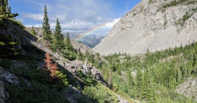
 The trail rose to run along the edge of a sandstone bluff some 200 feet above Little Paddy Creek. We perched on the edge of a slab and dangled our feet, looking out across three ridges, heavily clad in all shades of green. As per the trail-head guide, “Black, white, and post oaks, as well as hickories and shortleaf pines are the main tree species. Mixed hardwood forests can be found along the drainages.”
Though it would be dry-camping, there was ample space and several campfire rings attesting to this being a beautiful spot to spend the night. Along the higher points of the trail, the poisonous plants were much less prevalent, making it easy to find areas to set up a tent on a bed of leaves.
At mile 2.7 we crossed 7 ft. wide, ankle deep Little paddy creek, “one of several eponymous landmarks named for Sylvester Paddy, an Irishman who first logged this area in the early 1800s” (as per the “Rip & Go” sheet from Backpacker Magazine which clued me in to this little gem).
Day 1 – Evening – Paddy Creek Camp Ground 7.3 miles
From along the Bluff we dropped to Little Paddy Creek, likely a dependable source of water year round. Though we had been hoping to camp along the water, the beaches were rocky and there were no sites (another mile or so in there was another dry camp). Again, we chose to press on; Emily had made contact with one of the poisonous plants along the way and hives were springing up on her arm, although she insisted it did not itch, we planned to take to it with Dr. Bronner’s.
We moved along with greater confidence and more quickly as our encounters with mud lessened. An easy climb and another bluff traverse, followed by a steep descent brought us to Bid Paddy creek. A well established spur trail swung down toward the creek. It was so pronounced that it was hard to differentiate between it and the actual trail (which cut back into the trees, seemingly away from the creek). The map called for a stream crossing and Emily was more than happy to plunge in and rinse her legs, shoes, and affected arm so she scoped the land across the creek as I went back to explore the trail which followed in the other direction. Well, she got her wash and I found the trail, so we headed on.
The area opened up into a lush field with signs of a site for a winter camp (although very overgrown at this time of year). All variety of grasses grew thick around us, a distinct contrast to the nearly negligible undergrowth along the ridges. Immediately we emerged onto the rocky banks of Big Paddy Creek. This crossing was knee deep and the banks were much steeper. As I had opted to take off my boots to cross and the current was strong and the rocks were slippery, I was glad to cross linked with Emily.
A short but steep-ish climb (about 7 minutes) constituted the second steepest and longest climb to be encountered on this trail (the fore-leader in both these things comes a couple miles later).
After the climb we emerged onto a road and, as evening was fast approaching and the map was none too clear, we began looking for the campground. We walked downhill (west) about .4 miles and then swung east and followed a paved road up another.4 miles, only to pass where the actual trail (which had continued across the road) fed a much more direct route to the campground.
Either way, we got there, and had company. There were many canoers and holiday weekenders out enjoying the clear cold waters of Paddy Creek, which ran right along the campground. Though no running water, the creek was at hand. Park pit toilets, and trash cans were available and camping was a suggested donation of $5-$10. The camp host, Bruce, came by and offered us his encouragement. We were too busy setting up stoves and getting our pasta cooked to talk for very long.
Later that evening, Emily demonstrated a natural propensity and talent for Yogi’ing. I was impressed, as she scored us some drinks AND got them to turn down their Metallica and Nirvana tunes. Though there was plenty of company, everyone was quiet by 10 and the stars overhead were lovely.
Day 2 – Morning – Trail camp after climb from Big Paddy ~9 miles
We would have done ourselves a service to wade across the stream right at Paddy Creek Campground. Instead we back-tracked (west) on the road, caught the trail, headed back toward the camp on the trail (east), crossed the 12 ft wide, ankle deep Big Paddy Creek and then continued east through the jungly drainage bottom. It was mucky and muddy and we encountered many stagnant pools where the frogs dropped into conspiratorial silence as we passed, only to resume their animated free-for-alls once we moved away.
The trail swung around west and began to climb. About half way up there was a small campsite and then another more spacious camp at the top of the roughly 500 foot climb. We took a break here. A breeze cut the warmth, as did the shade. We looked down on a hawk gliding low. Cicadas hummed, birds sang, and frogs chirped. It was a lovely, secluded spot; in my perspective, much preferable to the campground.
The trail proceeded to be mostly flat, with only minor dips into drainages. We crossed another back country road then passed a spur which led to a parking lot where cavalcades were putting in. We passed one such group, at the head of which was a fella’ with the butt of a cigarette in his mouth and a bottle of suds in his fist. Told ya; quintessential Missouri.
About a mile from the spur we came to a large (again, dry) campground with a fire ring, room for several tents, and plenty of space for hitching horses. Here we met another hiker. A fellow from Nebraska, out with his 7 month old Golden Retriever, Oden.
We proceeded for a couple uneventful miles, passed the Y where a connector trail could cut the loop into a shorter hike (making this trail a figure 8). Opportunities such as this give the chance to practice map skills without the threat of dangerous repercussions.
We waded through more than 3 small, idyllic streams before passing a “Wild-life Pond and Food Plot.” Lily pads blanketed the pond where polliwogs swam, tiny frogs hopped, and a turtle napping on the tree fallen into the water acknowledged us with but a single lazy blink.
 As we came into the last few miles of the loop, the land began to dip and rise more. At the bottom of the third dip was the water fall. We swam, ate a late lunch, and rested on the moss before moseying up the last mile and a half of trail and back out to the car. We were back to the car by 4:30 and in Kansas City by 9.